Presentations & Speakers
.png)
TUESDAY, MAY 12, 2026
Presenter:

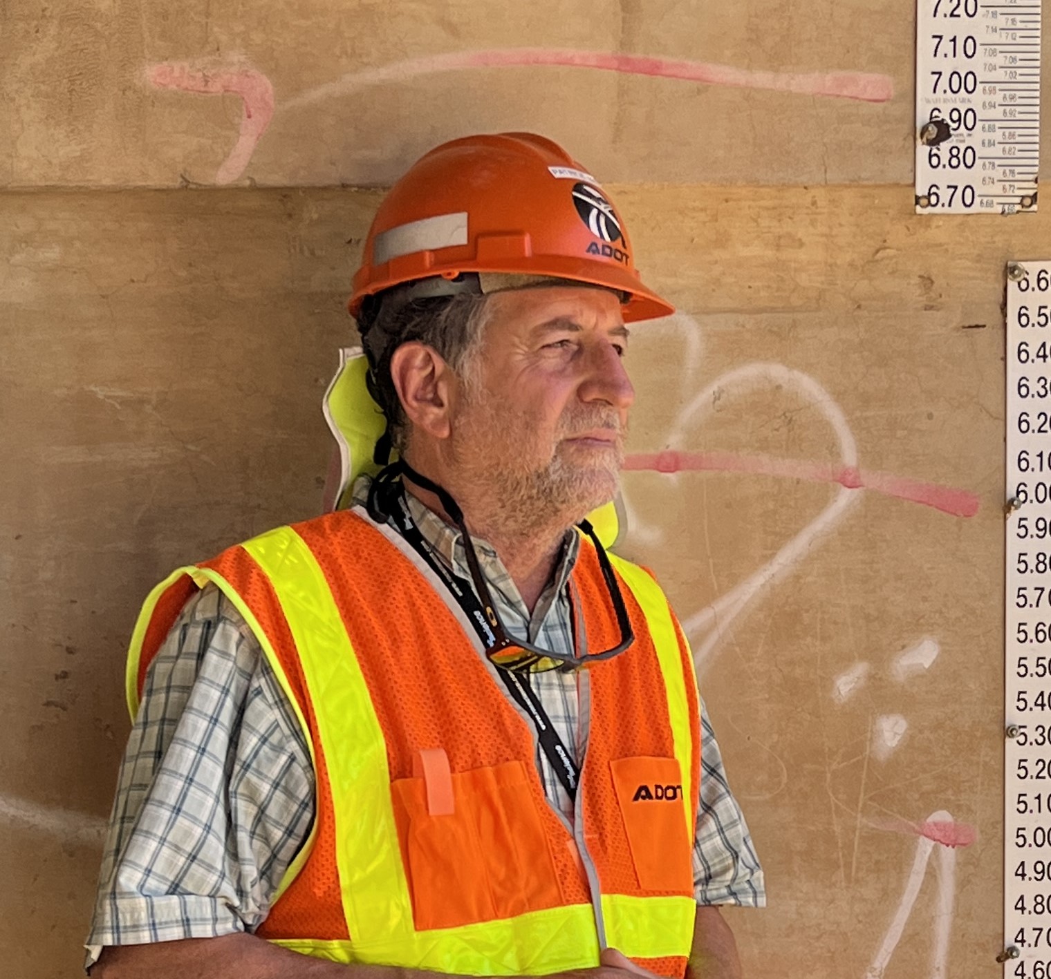
Audra Merrick
Audra Merrick serves as state engineer and deputy director, leading ADOT’s Multimodal Planning Division, Project Delivery and Operations Division, and Alternative Delivery and Major Projects Division. In this role, she oversees the development and delivery of ADOT’s construction program while driving the agency’s efforts to improve and sustain the safety and efficiency of Arizona’s transportation infrastructure.
Before taking on her current job, Audra previously served as Multimodal Planning Division director, Project Delivery and Operations Division director, and Infrastructure Delivery and Operations Division deputy state engineer. She also worked for nine years as the Northcentral district engineer.
Audra is a graduate of Lehigh University with a Bachelor of Science in civil engineering, and she is a registered civil engineer. Her expertise and her years of experience have played a key role in how ADOT responds to emergencies, including a landslide on US 89 in 2014 that required extensive earthwork and the reconstruction of a newly aligned 1,500-foot section of roadway. |
More Information Coming Soon!
Presentation Abstract:
Terracon performed the geotechnical engineering design services for the approximately $1B I-10 Broadway Road Curve Project (located in Phoenix, Arizona), which included 21 new bridge structures, over 80 retaining walls, 12 miles of 1- to 2-lane interstate roadway widening (in each direction), collector-distributor interstate lanes, associated local city roadway improvements, and a rockfall evaluation. The project was completed and delivered under an Arizona Department of Transportation (ADOT) Design-Build contracting mechanism with the Pulice-FNF-Flatiron Joint Venture (PFFJV) as the Design-Builder and engineering support provided by TY Lin International, Aztec Engineering and Stanley Consultants. Terracon Consultants, Inc. (Terracon) was the only geotechnical engineering consultant for the project. The presentation will summarize the geotechnical engineering highlights of the I-10 Broadway Road Curve Project, including some of the challenges to deliver a fast-paced large project, project logistics for the site characterization, as well as shallow and deep bridge foundation design and construction challenges.
Presenters:
Ramon Padilla
Ramon Padilla, P.E. (AZ, NM & NV) is a Senior Principal, Vice President, and Geotechnical Regional Manager for Terracon; obtained his BSCE in Mexico in 1998 and his MSE in 2000 from ASU; and was the Geotechnical PM for the I-10 BRC Project.
Don Clark
Don Clark, P.E. is a Senior Principal and Senior Consultant for Terracon; obtained his BSCE and MS from the University of Colorado. Mr. Clark opened the Terracon Phoenix Office in 1995 and has been a key contributor in its success. Mr. Clark was the lead Geotechnical Principal & Reviewer for the I-10 BRC Project.
Presentation Abstract:
Terracon performed the geological and geotechnical engineering design services for the widening of approximately 23.3 miles of I-17 roadway between Anthem Way TI and Sunset Point Rest Area. The Project had a significant rock cut and rock fill component, requiring the slope design and rockfall evaluation of 133 rock cuts comprising 65,000 linear feet of rock cut.
The presentation summarizes the implementation of the A-GaME approach for the Project which was submitted as an Alternative Technical Concept (ATC, specifically ATC 04). The presentation will focus on the advantages the A-GaME approach added to the Project, including improved site characterization, schedule benefits, cost savings, and reduction of safety risk.
The presentation also outlines a comprehensive, state-of-practice methodology for evaluating rock mass slope stability for transportation projects, with a focus on the integration of empirical, and geophysical approaches.
Presenter:
Scott Neely
Based in Terracon’s Phoenix office, Mr. Neely has 40+ years of experience managing geotechnical and structural projects across the U.S. His work spanstransportation, renewable energy, pipelines, transmission lines, substations, airports, and high-rise buildings, with specialized expertise in rock cut slope stability, slope stabilization systems, micropiles, MSE walls, and rockfall mitigation.
Presentation Abstract:
AZGS has completed several landslide mapping campaigns focused on major highway corridors in Arizona. Each study includes a literature review, Identification of potential slides through interpretation of aerial imagery and topographic data, and field verification and mapping of known and previously unrecognized landslide deposits. We first mapped landslides along Interstate 17 from Anthem to Flagstaff followed by mapping along SR 87 and 260 from Fountain Hills to Payson. We are currently finalizing new landslide mapping along US Route 60 from Florence Junction to Show Low.
Results of these studies include refined geologic mapping of the character and extent of previously known landslides and the addition of hundreds of newly identified landslide features to AZSLID. All updated mapping is freely accessible and available for viewing and download from our online geohazard viewer. Reports for each study are available on our online document repository.
Presenter:
Joseph Cook
Joe Cook graduated with a MS in Geosciences with an emphasis in Geomorphology from the University of Arizona in 2006. Since then, Joe has worked as a geologist with the Environmental Geology Group at Arizona Geological Survey (AZGS) in Tucson, Arizona. Projects have included mapping of the extent of Holocene alluvium along streams within the San Pedro, Verde, and Little Colorado River watersheds, surficial geologic quadrangle mapping, earth fissure and land subsidence studies, and statewide and project-specific landslide hazard mapping. Currently, Joe is a Research Geologist with AZGS, manages the earth fissure mapping program, and continues to map throughout the state.
Presentation Abstract:
What was supposed to be a straightforward geotechnical investigation for a bridge replacement project was anything but. During the exploration drilling for the drilled shafts, perched groundwater was encountered at shallow depths creating a wet, muddy, and sloppy environment for the drillers down to the final drilling depths reaching 115 feet. At the end of the first week of drilling, some of the drillers and helpers who choose to wear short-sleeved shirts noticed rashes on their arms. Once this was brought to ADOT’s attention, the drilling activity ceased immediately, and a determination of the cause was sought. As a result of this, requisite soil and groundwater analytical testing were conducted through a consultant that indicated contamination of phosphorus above the Arizona Department of Environmental Quality (ADEQ) soil cleanup levels. The rashes on the drillers’ arms disappeared after a few days and never reappeared and so did the opportunity for continuing and completing the field investigation since we did not want to further risk the drillers to exposure of phosphorus.
This situation created a series of unprecedented dilemmas for ADOT Geotechnical Services that required solutions. First, with only four of the eight required test borings completed for the bridge with no opportunity to return to the site due to the unknown effects of the deleterious soils, the realized subsurface information from the four completed borings (with at least one at opposing sides of the replacement bridge) were idealized to complete the missing test locations and were implemented in the final design of the replacement bridge. This act was in great variance of the ADOT standards for drilling quantities of a bridge. Secondly, the chemical properties of the soils collected by ADOT and their consultants had to undergo a series of chemistry tests that are normally performed only in situations where hazardous materials are encountered, which is not part of a typical geotechnical investigation or a design project. Thirdly, considerations for removal, storage, and disposal of the deleterious soil during construction of the drilled shafts had to be considered and planned appropriately for ADEQ requirements.
The presentation will cover the series of design and construction steps starting with the initial drilling activities, followed by the actions taken to identify the chemical properties of the soils, and then the construction sequence including removal, storage, and disposal of the deleterious soil, demolition of existing bridge, and completion of the new bridge.
Presenters:
Patrice Brun
Patrice Brun, PE, has served as the ADOT Bridge Group Assistant State Engineer for Geotechnical Services and Operations Manager since 2019.
Patrice originally joined ADOT in 2011 as a Design Engineer. The previous 12 years were spent as a geotechnical engineering consultant. He has had experience with most geotechnical exploration and design methods in his technical career. His first few years of geotechnical consulting were spent performing field explorations for everything from basic commercial/residential projects to stadium/arena projects. Project management came afterwards even though the field explorations continued as needed.
Patrice’s notable efforts at ADOT include preparing the Geotechnical Project Development Manual (GPDM), implementation of the Practical Geotechnical Exploration for Design (PGED) initiative, revised blasting specifications, and changes to the drilled shaft specifications. For several types of geotechnical environmental clearances, Standard Work processes were developed.
Patrice graduated from the New Mexico Institute of Mining and Technology in 1999 with a B.S. in Mineral Engineering

Jim Lemmon
Jim Lemmon is a registered Geologist in Arizona and has worked in water rights, groundwater hydrology, waste management and environmental issues for 30 years prior to joining ADOT in 2007. Since March 2015 he has been the Geologist in the Geotechnical Section of the Bridge Group at ADOT. His duties include investigating landslides and rock falls; triage of failing pavement and structures where geologic conditions are suspect; and a variety of geotechnical investigations associated with bridges, culverts, embankments and cut slopes.
Jim manages the inclinometer and slope measurement activities at the several dozen sites around the state where ADOT has installed over 100 inclinometers to monitor ground and slope stability. He is ADOT’s representative to the Arizona Geological Survey’s Geologic Mapping Advisory Committee, and serves as ADOT’s representative to the Center for Bio-mediated and Bio-inspired Geotechnics at Arizona State University (ASU).
Jim also serves on the Governing Board of the Tempe Elementary School District Number 3. He was first elected in November 2002 and then reelected to a 2nd, 3rd, 4th and the 5th term expiring in 2024. He has taught numerous geology and geography classes at Scottsdale Community College and the Rio Salado Community Colleges, and a class on Risk Assessment for Hazardous Materials for the Industrial Technology Department at ASU.
Jim is an US Army Vietnam veteran and received his undergraduate degrees in Forestry and Geology from Colorado Mesa University in Grand Junction, Colorado and his graduate degree in Geography from Arizona State University in Tempe, Arizona.
Presentation Abstract:
The National Center for Infrastructure Transformation (NCIT), led by Prairie View A&M University, is a national-tier University Transportation Center dedicated to advancing the durability and longevity of U.S. transportation infrastructure. Supported by a multidisciplinary consortium, including Arizona State University, Michigan State University, Rutgers University, and the Texas A&M Transportation Institute, NCIT brings together extensive expertise in infrastructure design, construction, maintenance, and policy.
Building on a strong foundation of leadership, innovation, and technology transfer, the consortium aims to transform transportation infrastructure systems through integrated research, education, and implementation efforts. The center’s vision encompasses both physical and policy-driven advancements to enhance infrastructure performance and resilience nationwide.
This presentation provides an overview of completed and ongoing projects at Arizona State University under NCIT, highlighting key contributions toward developing practical, implementable solutions that extend infrastructure service life and support sustainable transportation systems.
Presenter:

Claudia Zapata
Dr. Zapata is a geotechnical engineer and associate professor in the School of Sustainable Engineering and the Built Environment at Arizona State University (ASU). She also serves as Associate Director of the National Center for Infrastructure Transformation (NCIT), a U.S. Department of Transportation University Transportation Center.
Her research focuses on unsaturated and expansive soils, thermo-hydro-mechanical soil behavior under static and repeated loading, and the influence of environmental factors on pavement and foundation performance. She has authored more than 120 technical publications and contributed to advances in modeling fluid flow, shear strength, and soil volume change for infrastructure applications.
With over 25 years of experience, Dr. Zapata has consulted for major agencies, including the Federal Aviation Administration, U.S. Army Corps of Engineers, and multiple state departments of transportation. Her work includes airfield design evaluation, forensic analysis of pavement failures, and assessment of environmental impacts on infrastructure systems.
Her career highlights include contributions to the climatic models of the Mechanistic-Empirical Pavement Design Guide, development of methods to incorporate environmental effects into pavement design, and creation of a database of over 35,000 unsaturated soil profiles across the United States and its territories.
She has received numerous honors, including the 2025 Carl Monismith Award and the 2025 James M. Hoover Distinguished Lecture Award.
Presentation Abstract:
Between 2015 and 2025, the National Science Foundation funded the Center for Bio-mediated and Bio-inspired Geotechnics (CBBG), a collaborative effort among Arizona State University, U.C. Davis, New Mexico State University, and Georgia Tech, with $34.5 million dollars for research on biogeotechnical engineering. Over that period, CBBG developed innovative biogeotechnical technologies for a diverse group of geotechnical issues, including biocementation for ground improvement, mitigation of fugitive dust, enhancing liquefaction resistance, self-boring probes, and root-inspired anchors, foundation systems, and penetrometers. These developments represent the first wave of technologies in the emerging sub-discipline of biogeotechnical engineering, wherein geotechnical engineers learn from nature how to address important problems in a cost-effective manner. While NSF support has ended, the partner universities are working together to continue developing biogeotechnologies under the banner of the Consortium for Bio-mediated and Bio-inspired Geotechnics (still known as CBBG).
Presenter:

Edward Kavanzanjian
Dr. Edward Kavazanjian, Jr. is a Regents' Professor and the Ira A. Fulton Professor of Geotechnical Engineering at Arizona State University (ASU). He joined ASU in 2005 after 20 years in engineering practice. From 2015-2025, he served as Director of the Center for Bio-mediated and Bio-inspired Geotechnics (CBBG), a National Science Foundation-funded Engineering Research Center. His expertise includes biogeotechnical engineering , geotechnical earthquake engineering, design of waste containment systems, and the properties of solid waste. He has been recognized by election to the United States National Academy of Engineering and as a Distinguished Member of American Society of Civil Engineers.
WEDNESDAY, MAY 13, 2026
Presentation Abstract:
State DOTs collect vast amounts of geotechnical data, yet much of it remains locked in scattered files and legacy systems. As agencies move toward digital delivery, a key insight emerges: data management and tool development are different tasks—but they work best in parallel. Geotechnical engineers can organize and validate data using modern standards and APIs without becoming software developers. Once data is reasonably structured, specialists who bridge engineering and software can build tools that address real design and construction needs.
The Louisiana Department of Transportation and Development (LADOTD) is applying this approach by connecting soil borings, CPTs, deep foundation, and monitoring data through a shared, API-based system. This enables commercial and custom tools to access the same data for visualization, automated analytics, and design workflows. Real examples show that meaningful results can be achieved without a full data overhaul—practical standardization is often enough to make geotechnical data immediately useful.
Presenter:

Xin Peng
Xin Peng is a Geotechnical Engineer at Geosyntec Consultants, Inc., specializing in geotechnical data management, digital delivery, and decision-support workflows for transportation infrastructure. He has over 10 years of experience spanning consulting practice and applied research, supporting DOT projects from site investigation through construction. Xin received his Ph.D. from The University of Texas at Austin and holds a Professional Engineer (PE) license in Louisiana. He is an active member of TRB AKH17 Structural Foundations Committee, the DFI Information Management Systems Committee, and ASCE Geo-Institute committees, focusing on advancing standardized, interoperable geotechnical data practices.
Presentation Abstract:
Manual core defect logging is a vital part of geotechnical investigations, but it is often slow, repetitive, and prone to inconsistencies when transferring information from handwritten notes, images, and PDF logs into digital systems. This presentation explores how TabLogs is applying computer vision and AI-driven document understanding to accelerate and standardize the identification and digitization of core defects from both core imagery and legacy borehole logs. It outlines the system architecture, workflow, and early trial outcomes from projects in Australia and the United States. Initial results show strong potential to reduce manual data entry time by 60 to 70 percent, while improving consistency and producing structured outputs ready for digital workflows. The presentation also highlights the importance of engineer review, current limitations, and future opportunities for expanding AI-assisted logging across a wider range of geotechnical data types.
Presenter:
.jpg)
Tom Le Heux
Tom is an Account Executive at TabLogs with a strong background in engineering geology and geotechnical risk management. Before joining TabLogs, he worked as an Engineering Geologist at 4DGeotechnics, providing geotechnical supervision on large-scale iron ore mine construction projects. His work involved managing geotechnical risk for clients, collaborating across teams to solve complex construction challenges, and leading field investigation programs in remote and challenging conditions. Tom holds a Bachelor of Science in Geology and a Professional Masters in Engineering Geology from the University of Canterbury. His postgraduate research focused on using LiDAR imagery to map slope hazards and better understand risk mitigation along transport corridors.
Presentation Abstract:
Dataforensics is leveraging AI and modern cloud technology to transform historical geotechnical data into a reliable, structured subsurface data asset. It highlights the challenges posed by legacy systems like gINT, including inconsistent schemas, poor data structures, missing information, and outdated formats. The presentation explains how migrating to Bentley’s OpenGround enables scalable, integrated workflows, improved data accessibility, and alignment with modern engineering standards. Dataforensics’ AI‑enhanced data extraction approach integrates OCR, machine vision, deep learning, LLMs, and algorithmic techniques to accurately capture information from logs, reports, plan sheets, and test results. With a robust data library built from decades of field activity and over 525,000 boreholes, the system improves accuracy, efficiency, and consistency across large datasets. Real‑world examples, include a major USACE migration effort, demonstrate significant time savings and strong ROI, making high‑quality subsurface data more attainable than ever.
Presenter:
Scott Deaton
Scott Deaton is President and Founder of Dataforensics, a software company that specializes in helping geo-engineers use technology to improve and streamline their data collection, data management, reporting, analysis and visualization processes. He has guided Dataforensics to become the first software vendor that can import and export DIGGS data in their software and pioneered the usage of DIGGS within the OpenGround Cloud environment. Dataforensics is responsible for many major implementations of OpenGround in North America for organizations like the U.S. Army Corps of Engineers, LADOT, OHDOT, NMDOT, MSDOT, MODOT, ILDOT, WSP/Golder, Haley & Aldrich, S&ME, Braun Intertec and many more.
Presentation Abstract:
Geohazard management is evolving rapidly with the integration of artificial intelligence (AI) and machine learning into engineering practice. This presentation will provide an overview of recent advances in applying AI to geotechnical risk identification and decision support, drawing on practical examples from Colorado and beyond. We will discuss how AI-driven tools can supplement traditional engineering judgment by efficiently identifying embankment failures and supporting risk-based asset management at scale. The session will highlight lessons learned in developing and validating these systems, the importance of expert input and iterative refinement, and the opportunities and limitations of AI for geohazard professionals.
Presenter:

Randy Post
Randy is an Assistant Vice President, Geotechnical Engineer, and Senior Technical Principal at WSP in their Tucson office. He has over 24 years of experience in geotechnical engineering for transportation and infrastructure projects. As WSP’s North Mountain Geohazards Team Leader, Randy has overseen the design or review of mitigation solutions at more than 200 rockfall, debris flow, and embankment failure sites across the western U.S. He is passionate about helping owners proactively manage their geotechnical assets and associated risks. He is a registered professional engineer in Arizona, Colorado, Utah, New Mexico, Wyoming, and Idaho.
Presentation Abstract:
As the geotechnical profession shifts toward a more data‑centric paradigm, adopting tools such as Continuous Compaction Control (CCC) will be essential to modern earthwork quality assurance (QA). CCC enables near-continuous monitoring of the compaction process by equipping a compaction roller with a data acquisition system. This presentation will provide a brief overview of CCC technologies and discuss CCC’s advantages, as well as considerations for its future implementation in earthwork QA operations. It will also present two FHWA case studies: one involving the use of CCC during the construction of FHWA’s third-generation Pavement Testing Facility, and another during the reconstruction of an unpaved gravel road in partnership with the Virginia Department of Transportation (VDOT), aimed at exploring the potential advantages of CCC in improving maintenance practices for unpaved gravel road management. The results presented herein will help illustrate CCC’s role with modernizing earthwork Compaction QA protocols.
Presenter:

William "Tripp" Baker
Tripp Baker is a researcher with a formal background in Geotechnical Engineering where he obtained his PhD from the University of Delaware. Currently, Tripp provides technical support services for the Federal Highway Administration at the Turner-Fairbank Highway Research Center. Tripp’s research focuses on wave‑based testing and analysis techniques included shear wave velocity measurements and working with novel compaction technologies, such as Continuous Compaction Control.
Presentation Abstract:
Due to Louisiana’s soft soils, new structures can pose problems either due to slope stability concerns or excessive settlement. This sometimes will necessitate the use of ground improvement techniques. On a LADOTD project, ground improvement was needed to support the proposed the new roadway. LADOTD decided to design the state’s first column supported embankment on a geosynthetically reinforced load transfer platform. This project located in French Settlement, Louisiana would support approximately 13 feet of embankment. With our research center we instrumented the LTP during construction to gauge performance with the hope of having our own calibrated models for design. Presentation will include some pictures from during construction, instrumentation, and an overview of the project, and lessons learned in the field.
Presenter:
Miranda Perkins
Miranda Perkins is a registered PE in her home state of Louisiana where she currently serves as the Geotechnical Engineering Manager for LADOTD. She has been with the LADOTD for 9 years. Miranda has a BSCE and is currently working on her Masters at LSU.
Presentation Abstract:
This presentation will summarize the recently completed NCHRP research effort to develop a performance based specification guide for the use of ground modification technologies in the transportation community. We will review some of the key points including the geotechnical documents, method selection, design and construction submittal process and quality control. This is a guide to assist agencies in implementation of a different project delivery approach allowing for innovation from contractors and streamlining the design development process.
Presenter:
.jpg)
Allen Cadden
Allen Cadden, PE, BC, GE, is a Principal with Schnabel Engineering in Chadds Ford, PA and was the Principal Investigator for NCHRP 10-121. Mr. Cadden helps lead the geostructural engineering and infrastructure monitoring services for Schnabel and is a member of their Research, Development and Innovation Steering Group. He is a past President of the Geo-Institute of ASCE and a member of the Deep Foundation Institute Board of Trustees. Allen received his BSCE and Master of Engineering from Virginia Tech in the 80’s and is a licensed engineer in eleven states.
Presentation Abstract:
One major use of MSE walls is for bridge approach embankments that typically require a Roadside Barrier System on top of the MSE Wall. Understanding the behavior of the roadside barrier system and the interaction with the MSE wall design is critical. At first, the behavior was misunderstood, the dynamic impact load was used to design the moment slab, and the result was a very large moment slab which caused an increase in the project cost. So, in response, AASHTO, in cooperation with FHWA, started to develop Guidelines for Design of Roadside Barrier Systems Placed on MSE Retaining Walls under the National w Highway Research Program (NCHRP).
This presentation will discuss the NCHRP report and how it affects both the roadside barrier system and the MSE wall. Also, we will compare the current AASHTO guidelines vs the new NCHRP Guidelines, the effect on the MSE wall design and discussion/observations on how the new NCHRP report is being used across the DOT’s.
Presenters:

David Hutchinson
David Hutchinson is currently the Director of Engineering for Geoquest, USA and is in Dallas/Fort Worth. He has over 39 years of experience in the design of MSE walls. He manages over the technical issues for the company and has a vast array of experience as a structural and geotechnical engineer. He routinely consults with Department of Transportation’s and consultants on MSE wall technology.
He is a member of ASCE, Geo-Institute, TSPE and the Transportation Research Board (TRB). He is a registered Professional Engineer in 17 states. He graduated from Texas A&M University with a Bachelor of Science degree in Civil Engineering in 1984.

Jack Mackie
Jack Mackie is currently the Engineering Manager for The Western Division of Geoquest, USA and is located in Denver, Colorado. He has about 15 years of experience in the design of MSE walls and manages a team of 10 engineers that design MSE walls and other precast concrete structures offered by Geoquest, USA.
He is a member of ASCE and is a registered Professional Engineer in 15 states. He graduated from Texas Tech University with a Bachelor of Science degree in Civil Engineering in 2012 and from The University of Texas at Arlington with a Master of Engineering degree in Structural Engineering in 2016.
Presentation Abstract:
Most Mechanically Stabilized Earth (MSE) walls with large panel systems traditionally use steel soil reinforcement, which often requires imported backfill meeting strict corrosion criteria. When suitable local backfill is unavailable, this approach can be costly and environmentally burdensome. Geosynthetic reinforcement offers a sustainable alternative, enabling the use of locally available materials with less restrictive backfill requirements.
This presentation examines the design approach and construction challenges of geosynthetic strip–reinforced MSE walls built with sustainable local backfill. Although geosynthetics are widely used, fully mechanical connections between geosynthetic strips and large precast concrete panels represent a recent industry advancement.
A case study of MSE walls up to 36 ft high in a high seismic region of California is presented. The walls used high-tenacity polyester geosynthetic strips designed per AASHTO LRFD for extensible reinforcements. Key challenges included uniformly graded SP-SM backfill with ~5% fines, maintaining wall face alignment, and accommodating utilities within the reinforced zone.
Presenter:

Fransiscus Hardianto
Fran is Chief Engineer at SSL with over 30 years of experience in public infrastructure. He holds an MSCE from the University of Wisconsin–Madison and is licensed as a GE and PE in California and other western states. He is a Board-Certified Geotechnical Engineer (BC.GE) and an active member of the Academy of Geo-Professionals’ Public Infrastructure Committee. Fran is an ASCE Fellow and a member of the Geo-Institute’s Earth Retaining Structures Committee, with some publications on MSE walls, seismic engineering, soft ground stabilization, and environmental geotechnics.
Presentation Abstract:
Population growth and climate change are increasing exposure to geohazards such as rockfalls, avalanches, debris flows, and slope failures. Building resilient infrastructure in these environments requires adaptable engineering strategies. Mechanically Stabilized Earth (MSE) systems provide a flexible, efficient solution by offering structural strength, energy dissipation, and constructability under demanding conditions. This presentation features a real-world case study where MSE technology was applied successfully to protect against rockfall and avalanche impacts. The design approach, construction methods, and performance results demonstrate MSE walls as a reliable, high-performance mitigation option for mountainous, hazard-prone regions.
Presenter:
Manuel Bernal
Manuel Bernal is a Civil Engineer with over 13 years of experience at Geoquest, specializing in geotechnical projects overseas. Throughout his career, he has contributed to several major developments, focusing on innovative design strategies and practical, cost-effective engineering solutions.
Manuel joined Geoquest USA in November 2024 as the Regional Manager for the Southwest Region in California, bringing extensive expertise in retaining, Protective and Crossing systems, project management, and sustainable engineering practices.
Presentation Abstract:
There are many options to consider when it comes to dealing with the challenges associated with slope reinforcement stability and soil anchoring. Utilizing Percussion driven earth anchors (PDEAs) in conjunction with existing soil reinforcement technologies; or to replace traditional soil anchoring technologies can significantly reduce project cost, duration, and complexity.
Engineered percussion driven earth anchor systems reduce or eliminates the need for grading while significantly increasing global stability. PDEAs can complement vegetated and non-vegetated soil reinforcement systems. Vegetated systems utilize a rolled erosion control product that facilitates vegetation growth; and offers improved filtration; and allow for cleaner, cooler water discharges. Non-vegetated systems typically utilize articulated concrete blocks, cement impregnated fabrics, or wire-enclosed riprap; and offer superior mechanical and environmental durability. Both systems provide a surficial membrane that can be used with PDEAs to increase global slope stability by intersecting shallow failure planes.
Percussion driven earth anchors are also ideal alternatives for light to medium duty tension anchor applications. PDEAs can provide unmatched performance and simplicity relative to their low cost as opposed to traditional soil anchoring techniques such as soil nails and helical piles. PDEAs are a smaller, lighter, and cheaper anchoring system which allows them to be installed with smaller and simpler equipment. This reduces cost and challenges with site clearance and location.
This presentation will review components typically used in engineered slope reinforcement and stability systems; as well as where and how they can be used to replace traditional soil anchoring technologies. We will discuss the parts of a PDEAs assembly and how the anchor system works. We will discuss soil reinforcement products, their components, performance differences, and proper installation techniques. We will also discuss how to identify scenarios where PDEAs are superior tie-back technology and how they can be incorporated into existing designs.
Presenter:
Rick Ruffing
Rick is the Civil Division Manager focused on technical sales for Gripple Inc., a globally recognized manufacturer, delivering innovative, value-added solutions to construction, agricultural, civil, and solar markets.
Rick is on the Civil Products Team and specialized in offering a full range of anchoring and bracing solutions engineered for erosion control, slope stability, and stormwater applications. He has 25 years of experience in Erosion Control and Stormwater Management practices with an intimate knowledge of many products and practices used in providing slope stability and sediment control of runoff and sheet flows. Rick’s a graduate of Washington and Jefferson College with a degree in Business Administration.
Presentation Abstract:
During the last few decades, millimeter-to-centimeter thin photosynthetic communities developing on the surface of soils, known as biological soil crusts or biocrusts, have emerged into the limelight from relative obscurity. The presence and activity of biocrusts alters the soil character and function in often positive ways. Carbon and nitrogen fixation from the atmosphere and the extraction of other nutrients from trapped dust particles make biocrusts effective soil fertility agents. Their binding together of mineral soil particles armors soil surfaces against aeolian and water erosion, promoting stabilization and suppressing the formation of fugitive dust. Trampling by cattle, humans, and vehicles is currently regarded as the number one enemy of biocrusts in arid lands impacted by human activity. In these areas, biocrust cover is now relegated to landscape islands protected from agricultural and other forms of intensive land use. The level of development and ubiquity attained by biocrust in remote or protected landscapes offers us a glimpse of the true extent that these soil biofilms might have attained everywhere in the not-so-distant past. During the past few decades, this realization has spearheaded the development of an applied discipline in itself: biocrust restoration. I will review efforts in biocrusts restoration, focusing on its potential to curb fugitive dust in a self-sustaining way, and address two of the main current constraints to implementation: inoculum production at scale, and inoculum survival in field restoration targets.
Presenter:

Ferran Garcia-Pichel
Ferran Garcia-Pichel is a Regents Professor at ASU and the Director of the Center for Fundamental and Applied Microbiomics at the Biodesign Institute. He is a microbiologist by training and has worked for many years on the role of bacteria in nature, particularly in extreme environments. He is a fellow of the American Geophysical Union, the Ecological Society of America and the American Academy of Microbiology. He has specialized in the study of biocrusts, small topsoil communities of bacteria and cryptogams that play an important role in the ecology and sustainability of arid lands. For the last two decades he has been involved in efforts of ecological restoration of arid soils using biocrusts.
Presentation Abstract:
Geotechnical projects increasingly span multiple sites, facilities, and stakeholders, creating challenges in maintaining consistency, collaboration, and data integrity. Fragmented systems and siloed workflows often lead to inefficiencies, duplication, and delays in decision-making. This presentation explores a unified approach to geotechnical data management that consolidates the entire data lifecycle—planning, field collection, laboratory analysis, instrumentation, visualization, and reporting—into a single, integrated framework. By centralizing data and enabling seamless interoperability with GIS, CAD, BI, and project management systems, organizations can standardize processes across diverse operations while preserving long-term data assets. Designed for scalability, this approach supports multi-project portfolios and complex geotechnical programs, ensuring that teams work from a common source of truth. Automated validation and governance improve data quality and defensibility, while integrated workflows enhance transparency and collaboration among engineers, consultants, and project managers. Attendees will gain practical strategies for implementing interoperable, enterprise-level solutions that break down silos, streamline workflows, and deliver actionable insights for mission-critical
Presenter:
Tim Parker
Tim Parker earned his degree in Geology from UNC Wilmington. After graduating, he joined the Peace Corps in Ukraine, where he served as an Environmental Advisor. Upon returning to the U.S., Tim worked as a geologist, specializing in in-situ bioremediation projects for chlorinated solvents.
In 2024, Tim joined EarthSoft as a Business Development Manager, partnering with organizations to modernize environment and geotechnical data management workflows and enable more efficient, defensible use of their data. Outside of work, Tim enjoys coaching youth and adult soccer and running long-distance mountain trails.
Presentation Abstract:
Construction of new infrastructure adjacent to active railways in urban environments presents significant geotechnical and structural challenges, requiring meticulous analysis to ensure stability. This paper examines a case study involving the excavation for a new bridge foundation situated immediately adjacent to an existing, operational railway bridge. The excavation depth and proximity to the existing foundation necessitated a robust support system using sheet piles and struts to mitigate soil displacement and associated risks. A comprehensive analytical methodology was employed, integrating structural and geotechnical models. Service loads from the superstructure were determined using finite element analysis (SAP2000) and subsequently applied in a detailed finite element model (PLAXIS 2D) to simulate a staged excavation sequence. Six distinct construction phases were modeled, incorporating site-specific soil profiles ranging from silty sands to stiff clays, to accurately assess interactive behavior. The results confirmed the efficacy of the proposed support system. Under service load combinations, both the existing foundation and the sheet pile wall exhibited displacements within acceptable limits. Stress analysis indicated no development of plastic points or signs of incipient soil failure. The strut system provided essential lateral restraint, ensuring global stability during excavation. This study underscores the critical importance of integrated, staged construction analysis for complex urban excavations near sensitive infrastructure. The methodology and findings provide a validated framework and practical insights for the design and execution of similar deep foundation projects where safeguarding existing operations is paramount.
Presenters:
Hassan (Kevin) Abbasi
Hassan (Kevin) Abbasi, PhD, P.Eng., is a Senior Bridge Engineer at Parsons with over 25 years of experience in structural, bridge, and hydrotechnical engineering. He holds dual master’s degrees in Structural and Hydrotechnical Engineering and a PhD in Structural Engineering. Kevin has served as principal structural engineer and design lead for more than ten major earthfill and concrete dams in Iran, overseeing dam bodies and hydraulic structures, and he also led the design of a concrete arch dam in Afghanistan. His international experience includes leading structural design for high-rise buildings in Australia using post-tensioned systems and contributing to major programs such as the California High‑Speed Rail, John F. Kennedy International Airport, and Toronto’s Lake Shore East Corridor. He has taught at universities, reviewed international journals, and published nearly 50 peer-reviewed papers. His expertise spans seismic analysis, rehabilitation, and multidisciplinary design for major transportation, water, and infrastructure projects worldwide.

Mostafa Sotoodeh
Mostafa Sotoodeh, PE, is a Senior Supervising Engineer at Parsons with 20 years of extensive experience in bridge structural engineering. He holds a Master of Science in Structural Engineering from Florida International University and is a registered Professional Engineer in both California and Florida. Throughout his career, Mostafa has specialized in the design and analysis of complex bridge superstructures, substructures, and deep foundations, with particular expertise in post-tensioned cast-in-place viaducts and accelerated bridge construction (ABC) methods. He has served as a structural lead on landmark multi-billion-dollar programs, including the California High-Speed Rail, Port of Miami Tunnel in Florida and as an On-site oversight on St. Croix River Crossing extradosed bridge project in Minnesota. Proficient in advanced modeling software such as SAP2000, LARSA, and RM Bridge, he excels at resolving intricate constructability challenges to bridge the gap between design and field execution. Additionally, he is a certified Level 2 Multistrand PT Specialist through the Post-Tensioning Institute
THURSDAY, MAY 14, 2026
Presentation Abstract:
Levees built on soft foundation soils often experience excessive settlement, instability, and high long-term maintenance demands. Conventional solutions—reducing embankment weight or improving foundation soils—can be costly, environmentally disruptive, and slow to construct. Low-Density Cellular Concrete (LDCC) is a lightweight, closed-cell material with favorable strength-to-weight performance and high flowability that can substantially reduce foundation loading while maintaining required levee geometry and performance, making it attractive where subsidence and settlement control are critical. However, LDCC adoption in levee systems has been limited by a lack of design guidance tailored to its behavior. This paper presents a structured LDCC levee design framework adapted from established lightweight embankment and geofoam methodologies, addressing serviceability and ultimate limit states and providing stepwise checks for settlement, slope stability, seismic effects, hydrostatic uplift, and wind-induced translation. A Foster City, California, improvement project demonstrates application under weak-soil and permitting constraints to enhance long-term flood resilience.
Presenter:

Nico Sutmoller
Nico Sutmoller is Director of Sustainability and Resilience and Global Lightweight Fill Specialist at Aerix Industries. He supports geotechnical, civil, and structural teams on settlement mitigation, lateral load reduction, slope stabilization, and load reductions over buried utilities. Since the 1990s, he has delivered lightweight fill solutions for commercial and infrastructure projects across the United States and the Caribbean, with extensive geofoam experience in ultralight fill markets. He has authored numerous publications on lightweight fill materials and frequently presents to ASCE chapters, geotechnical conferences, USACE districts, and DOTs. He also partners with contractors to implement Aerix technologies, including patented pervious cellular concrete.
Presentation Abstract:
Ultra-lightweight foamed glass aggregate (FGA) presents a viable solution for enhancing slope stability by mitigating driving forces within geotechnical stability analyses. Its low unit weight contributes to reduced shear stresses, while its high permeability facilitates effective subsurface drainage, thereby minimizing the development of excess pore water pressures within embankment structures.
This presentation will highlight multiple case studies that illustrate the practical application and performance of FGA in challenging geotechnical environments. A particularly noteworthy example is the June 2024 failure of the Teton Pass roadway embankment along Wyoming Highway 22. The reconstruction effort was complicated by the site's high-altitude, mountainous terrain, limited accessibility, and severe winter weather conditions. These site-specific constraints—coupled with the necessity of an accelerated construction timeline—shaped a novel engineering strategy for the design and execution of a permanent stabilization system incorporating foamed glass aggregate (FGA) and complementary geotechnical components.
Presenter:

Theresa Andrejack
Theresa Loux is the Chief Technical Officer for Aero Aggregates of North America, the first vertically-integrated foamed glass aggregate manufacturer in the U.S., where she manages R&D activities, technical documentation efforts, and engineering support and outreach. In addition to her work at Aero, Theresa is currently an adjunct professor at Rowan University and the immediate past-Chair of the ASCE Geo-Institute’s Delaware Valley Chapter.
Presentation Abstract:
Fill of abandoned pipes and fill of the annular space when sliplining pipes are common tasks for departments of transportation. Versions of flowable fill or cement grout are commonly used for this purpose. Lightweight cellular concrete (LCC) represents an alternative that can potentially provide a cost-effective and technically superior solution. This presentation will discuss a recent partnership between the Kansas Department of Transportation, Maxxon, and the University of Kansas to evaluate the effectiveness of using LCC as void fill for voids beneath pavement, and for filling the annular space between two pipes. The annular space between a 24-inch diameter, 270-foot long pipe lined with an 18-inch plastic pipe was grouted with LCC, and a 60-foot long pipe was grouted with flowable fill. A series of interconnected voids beneath a simulated pavement were also filled with both LCC and flowable fill. Annular spaces for both pipes were completely filled, however the LCC was less viscous and was more capable of passing through small voids and was much more effective at filling the voids beneath the simulated pavement.
Presenter:

Robert Parsons
Dr. Bob Parsons is a Professor in the Civil, Environmental, and Architectural Engineering Department at the University of Kansas. He came to KU in 1998 after finishing his PhD in Civil Engineering at the Georgia Institute of Technology. In addition to teaching at the graduate and undergraduate level, Dr. Parsons has an active research program with emphases on soil stabilization, lightweight cellular concrete, aggregate testing, deep foundations, mechanically stabilized earth, and railroad ballast characterization and improvement. He is an author of more than 100 publications for many research journals, conference proceedings, and technical reports. Dr. Parsons also serves as Director of Facilities and Special Projects for the School of Engineering at KU, where he represented the School on the construction of two new buildings and renovation of the Engineering Library and ongoing construction, coordinates program accreditation, manages the school speaker series, and other activities.
Presentation Abstract:
Spring 2024 rains caused major flooding across Southeast Texas, severely impacting the Trinity River basin south of Lake Livingston. The FM 787 bridge approaches in Liberty County experienced significant washouts, forcing a full bridge closure and creating detours of more than an hour for nearby communities. Following the closure, teams conducted rapid damage assessments to help guide decisions and develop emergency repair plans aimed at restoring connectivity as quickly as possible.
This presentation will summarize the bridge’s background, the extent of the damage, the repair strategy, and the key design and construction challenges encountered.
Presenter:
Worku Mergia
Worku Mergia, P.E., is the Branch Manager of the Geotechnical Branch within Bridge Division, where he manages TxDOT’s statewide geotechnical engineering program. In this role, he is responsible for geotechnical design and plan development, PBLR, PS&E, and shop drawing reviews, construction-phase engineering support, scour analyses, and rehabilitation of geotechnical and earth-retaining structures. He is also responsible for the development of TxDOT’s geotechnical related policies and standards, including bridge scour management policies.
Presentation Abstract:
Discover how the Federal Highway Administration’s NextScour: Geotechnical Research Program is enhancing bridge scour analyses through advancements in our understanding of soil erosion. Since its inception over five years ago, NextScour has generated new erodibility data, refined testing protocols, revealed critical insights, and delivered practical results that will help state DOTs improve their risk‑based, data‑driven scour analyses, leading to safer, more cost‑effective bridge design. This presentation summarizes the Program’s formation, key developments, major breakthroughs, and future directions.
Presenter:

Jennifer Nicks
Dr. Jennifer Nicks leads FHWA’s Geotechnical Research Program in the Office of Infrastructure R&D and manages the Geotechnical Laboratory at Turner‑Fairbank Highway Research Center in McLean, VA. Her research advances the design, construction, and performance evaluation of bridge foundations, retaining walls, approach embankments, and geotechnical materials across a range of loading and field conditions. Dr. Nicks holds a B.S., M.Eng., and Ph.D. in Civil Engineering from Texas A&M and is a licensed PE in Virginia.
Presentation Abstract:
The Western Federal Lands Highway Division commissioned a dynamic instrumentation system to monitor two mid-slope rockfall attenuators along the Ketchum–Challis Highway in central Idaho, where snow, rockfall, and avalanche impacts have caused recurring structural damage. To better understand loading conditions and improve design, Landslide Technology installed a high-resolution system collecting data at 20 Hz. Each attenuator is instrumented with strandmeters, load cells, and strain gauges to measure cable forces and post stresses. A Campbell Scientific–based data acquisition system captures rapid load cycles from impact events, supported by solar power and battery storage for continuous operation. Data are transmitted via radio to a cellular-connected base station and cloud platform, enabling near-real-time monitoring and event detection through threshold triggers. Installed in summer 2025 using rope-access methods on steep terrain, the system is now operational and providing critical data to support more resilient rockfall and avalanche mitigation design.
Presenter:

Darren Beckstrand
Darren is a Senior Associate Geologist with Landslide Technology with 26 years of experience. He specializes in Geotechnical Asset Management, Geotechnical Instrumentation, and Slope Stability Concerns.
Presentation Abstract:
Highway and other linear infrastructure operators have long faced the challenge of managing geohazards, such as rockfalls, landslides, and asset deterioration, across extensive systems.
Recent advances in remote sensing and data analytics are quickly transforming the practice, with efficiency gains in expanding hazard and asset inventories and risk-informed decision support. An implementation example from the Colorado Department of Transportation (CDOT) involves annually measuring geohazard and geotechnical risk exposures to traveler safety, traffic disruption, and ownership costs. This approach, when applied at the network scale, showed that approximately 40% of the network is exposed to some level of risk from geohazards and geotechnical assets.
When combining probability-based hazard inventories with near-real-time data on changes resulting from events such as seasonal precipitation extremes or wildfires, operators can forecast adverse changes in risk at the site scale and prioritize mitigation before failures occur.
Presenters:

Mark Vessely
Mark Vessely is a Principal Engineer with BGC who works with US and Canadian transportation and mining clients motivated to manage risk from geohazards and asset deterioration. Mark was the Principal Investigator for NCHRP Report 903 on the implementation of geotechnical asset management, has been a key contributor to the CDOT Geohazard Management Plan since 2012, and is involved in implementing retaining wall asset management plans for the Colorado and Montana DOTs.
Scott Anderson
Scott Anderson is a Senior Principal Geotechnical Engineer at BGC, a former member of the National Academies of Science, Engineering and Medicine’s Committee on Geological and Geotechnical Engineering, a Steering Committee member of the National Science Foundation Geotechnical Extreme Event Reconnaissance Association, the former leader of the U.S. Federal Highway Administration’s technical resources in geotechnical engineering and a former professor at the University of Hawaii, which is where the SW Geotechnical Engineering Conference was when he first presented. He has his doctorate from UC Berkeley, practices around the world and makes his home in Colorado.
Presentation Abstract:
Recent advances in AI have made it possible for engineers to build practical software tools without relying on large commercial platforms. Civil design tools, engineering analysis applications, and visualization and reporting software can now be created quickly with AI assistance. As a result, firms and DOTs are moving from a few centralized tools toward many smaller, custom-built applications developed in-house.
This shift makes data quality and access control the critical bottleneck. Poorly structured or duplicated datasets quickly undermine these downstream workflows. More importantly, as custom applications begin connecting through APIs and shared data sources, geotechnical data subject to client NDAs and contractual restrictions can appear in places it does not belong.
This presentation focuses on data sovereignty: ensuring that every tool and every user can only see the data they are explicitly authorized to access. Attendees will gain a practical framework for thinking about data quality, connectivity, and permissions as AI enables a new generation of custom geotechnical software.
Presenter:
Louis Aaron
Louis Aaron is the founder of BoreDM (short for Boring Data Management), a modern borehole data management platform selected by twenty state DOTs and industry-leading firms to replace gINT in its first three years on the market. BoreDM works with state agencies, small geotechnical shops, and large global firms to enhance time-tested workflows and develop modern efficiencies for an increasingly data-driven industry. Louis holds an engineering degree from Princeton University. Prior to founding BoreDM, he briefly worked in management consulting at Boston Consulting Group and on the project development team building 12-foot diameter tunnels at The Boring Company.
Presentation Abstract:
Significant changes in the geotechnical program at FHWA have changed the way that programs will be delivered and State DOTs will be supported in project delivery, research and development and implementation. This presentation will provide information on the available resources for support of state programs, current initiatives and developments from the geotechnical team, and thoughts on the future of the program. Focused discussion will include work on a large scale research effort running with the decommissioning of an outdoor geotechnical laboratory and efforts to address quality assurance issues in large diameter drilled shaft construction.
Presenter:

Silas Nichols
Silas Nichols is the Principal Geotechnical Engineer for the Federal Highway Administration’s Office of Infrastructure. Silas is responsible for providing leadership and direction for the FHWA National Geotechnical Team through policy support, technical developments, and coordination with industry and professional groups. Silas’ experience is in both public and private sector engineering work and includes design and construction services for numerous routine and complex or unusual projects throughout the United States; development and delivery of instructor led and web-based training for continued education of transportation engineers; development and delivery of university courses; invited and keynote presentations; authoring technical articles and editorial columns; and various levels of participation on technical and steering committees. Silas is a Certified Instructor and a Master Trainer for the National Highway Institute (NHI) and teaches classes part-time at the University of Delaware. Silas has a bachelor’s degree in civil engineering from Syracuse University, and a master’s degree in Geotechnical Engineering from Tuft’s University.
.png)

.png)